
Built on decades of expertise and proven algorithms CARIS HIPS and SIPS is the leading hydrographic data processing system capable of integrating bathymetry, laser scanner, seafloor imagery, and water column data processing in a single application.
As a hydrographic surveying teacher, I have seen firsthand how important accurate data processing is to the success of a surveying mission. One of the most useful tools for this process is Teledyne CARIS, a software suite designed specifically for hydrographic data processing. In this article, I will explain why Teledyne CARIS’ HIPS and SIPS modules are the best choice for processing hydrographic data, from a teacher’s perspective.
Benefits of Teledyne CARIS:
Teledyne CARIS is an incredibly powerful tool for hydrographic surveying, providing a range of benefits that make it indispensable to surveying teams. Firstly, it offers accurate and efficient data processing, allowing surveyors to quickly and accurately analyze large quantities of data.
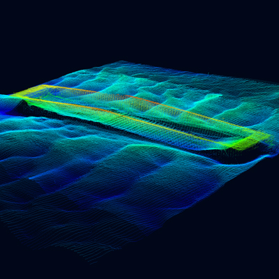
Secondly, Teledyne CARIS offers advanced data visualization tools, allowing surveyors to create 3D models of the seafloor that can be used for a range of applications, from maritime navigation to ocean conservation.
Finally, Teledyne CARIS is incredibly versatile, with modules that can be customized to suit the specific needs of different surveying projects.
Why HIPS and SIPS are the Best:
Of all the Teledyne CARIS modules, HIPS and SIPS are the best for hydrographic data processing for several reasons. Firstly, they offer the most advanced data processing tools, allowing surveyors to quickly and accurately analyze large quantities of data.
Secondly, HIPS and SIPS offer advanced quality control tools, allowing surveyors to identify and correct errors in data, ensuring that the final product is as accurate and reliable as possible.
Finally, HIPS and SIPS are incredibly easy to use, with an intuitive interface that makes it easy for surveyors of all skill levels to process data effectively.
Conclusion:
As a hydrographic surveying teacher, I highly recommend Teledyne CARIS’ HIPS and SIPS modules as the best choice for processing hydrographic data. Their advanced data processing and visualization tools, as well as their ease of use and versatility, make them indispensable to surveying teams. So, if you’re looking to enhance your hydrographic data processing capabilities, consider investing in Teledyne CARIS’ HIPS and SIPS modules.
References:
“Hydrographic Processing Solutions” by Teledyne CARIS, https://www.teledynecaris.com/en/solutions/hydrographic-processing-solutions/
“What is Hydrographic Surveying?” by NOAA, https://oceanservice.noaa.gov/facts/hydro-survey.html
Elements of Humor:
“Using HIPS and SIPS is like having a team of super-smart dolphins working for you, except they don’t eat all your fish.”