Underwater Photogrammetry Services
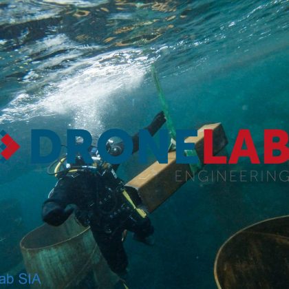
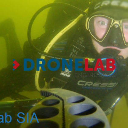
Unlock the power of high-resolution 3D modeling for submerged environments with our Underwater Photogrammetry services. This advanced technique involves capturing systematic, overlapping images of underwater structures, objects, or terrains using high-quality cameras mounted on underwater drones (ROVs) or other suitable platforms. Through sophisticated processing, these images are transformed into detailed, accurate, and measurable 3D point clouds and photorealistic textured models, providing an unparalleled digital representation of the underwater scene.
Why Utilize Underwater Photogrammetry?
Creating accurate digital records of underwater assets or environments is challenging. Underwater photogrammetry offers compelling benefits over traditional documentation or basic video inspection:
- Precision 3D Reconstruction: Generates geometrically precise models enabling accurate measurements of dimensions, areas, volumes, and distances directly within the digital model.
- Detailed Visual Records: Creates visually rich, interactive 3D representations (digital twins) that capture the condition and context of underwater sites with exceptional detail.
- Non-Contact Data Acquisition: Allows for thorough documentation and analysis without physically disturbing sensitive structures, artifacts, or habitats.
- Enhanced Analysis & Visualization: Enables virtual inspection, annotation, and sharing of complex underwater sites with stakeholders anywhere, facilitating better understanding and decision-making.
- Efficient Documentation: Provides a comprehensive baseline record for future monitoring, change detection, and condition assessment.
- Safety Enhancement: Can significantly reduce the need for extensive diver bottom time typically required for detailed manual surveys or measurements.
Indispensable for Detailed Underwater Assessment & Documentation:
- For Marine Engineering, Construction, Salvage & Archaeology Sectors: Require precise “as-built” documentation of subsea installations, detailed condition assessments of underwater infrastructure (pipelines, cables, foundations, ship hulls), meticulous mapping of archaeological sites, or accurate modeling for salvage planning? Underwater photogrammetry delivers the detailed, measurable 3D data needed for critical analysis, structural monitoring, heritage preservation efforts, and informed project execution.
- For Environmental Agencies, Research Institutions & Cultural Heritage Management: Need to accurately map and monitor sensitive underwater habitats like coral reefs or seagrass beds, document submerged cultural resources like shipwrecks, or conduct detailed scientific surveys of underwater geology or biology? Photogrammetry provides the capability to create high-resolution baseline maps and conduct repeatable surveys to quantify change over time. Generate powerful visualizations, extract valuable scientific data, and support conservation, research, and management objectives with robust 3D models.