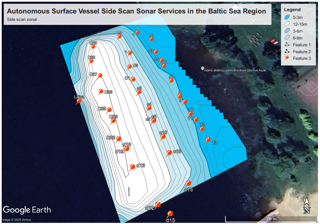
Autonomous Surface Vessel Side Scan Sonar Services in the Baltic Sea Region
The Baltic Sea region presents a unique and challenging underwater environment, characterized by complex geology, historical significance, and increasing maritime activity. Understanding this submerged landscape is crucial for various sectors, including offshore energy, infrastructure development, environmental monitoring, and security. Traditionally, surveying these waters has relied on manned vessels, which can be costly, time-consuming, and limited in their operational capabilities, especially in harsh weather conditions or sensitive areas.
Enter the era of autonomous surface vessels (ASVs) equipped with side scan sonar (SSS) technology. This innovative combination offers a paradigm shift in how underwater surveys are conducted, providing high-resolution imagery of the seabed with unprecedented efficiency, safety, and cost-effectiveness.
Why Autonomous Surface Vessels?
Autonomous surface vessels represent the cutting edge of marine technology. These unmanned platforms can navigate pre-programmed routes, collect data, and perform tasks with minimal human intervention. Their advantages are numerous:
- Extended Operational Endurance: ASVs can operate for longer durations than manned vessels, enabling more extensive survey coverage and reducing the need for frequent breaks or crew changes.
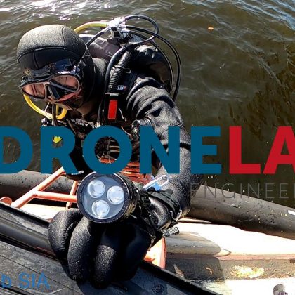
- Enhanced Safety: By removing the need for personnel on board, ASVs can operate in hazardous environments, such as areas with unexploded ordnance or during adverse weather conditions, mitigating risks to human life.
- Reduced Operational Costs: The absence of a crew translates to lower fuel consumption, personnel costs, and logistical expenses, making ASV surveys more economical in the long run.
- Improved Data Quality: ASVs can maintain consistent speeds and precise navigation, leading to more uniform and accurate data acquisition for side scan sonar systems.
- Environmental Friendliness: Many ASVs utilize hybrid or electric propulsion systems, resulting in lower emissions and a reduced environmental footprint compared to traditional vessels.
The Power of Side Scan Sonar
Side scan sonar is an acoustic imaging system that provides detailed, photographic-like images of the seafloor. It works by emitting fan-shaped pulses of sound waves to the sides of the vessel (or ASV) and recording the intensity of the echoes that return from the seabed and any objects on it. The strength of the backscattered signal depends on the material and texture of the seafloor, as well as the shape and size of any features present.
Key benefits of side scan sonar include:
- High-Resolution Imagery: SSS can reveal small objects and subtle changes in seabed texture, providing a level of detail often unattainable with other acoustic methods.
- Detection of Submerged Objects: Shipwrecks, pipelines, cables, debris, and other artificial or natural features on the seabed are easily identified in SSS imagery.
- Seabed Characterization: By analyzing the backscatter patterns, geologists and environmental scientists can map different sediment types and benthic habitats.
The Synergy: ASV and Side Scan Sonar in the Baltic Sea
Combining ASV platforms with advanced side scan sonar systems creates a powerful tool for underwater surveys in the Baltic Sea. This synergy offers significant advantages for a wide range of applications:
- Offshore Wind Farm Development and Maintenance: Detailed seabed mapping is crucial for site selection, foundation installation, cable routing, and ongoing inspection of offshore wind farms. ASVs equipped with SSS can efficiently survey large areas, identify potential hazards, and monitor the structural integrity of underwater assets.
- Pipeline and Cable Surveys: The Baltic Sea is crisscrossed by numerous pipelines and communication cables. ASVs with SSS can conduct precise route surveys, monitor their condition, and detect any potential damage or exposure.
- Environmental Monitoring: Understanding the distribution of different seabed habitats, identifying pollution plumes, and monitoring the impact of human activities requires detailed mapping. ASV-based SSS surveys can provide valuable data for environmental impact assessments and conservation efforts.
- Hydrographic Surveying and Charting: Accurate bathymetric data and seabed feature identification are essential for safe navigation. ASVs with integrated SSS can contribute to high-resolution charting of the Baltic Sea.
- Search and Recovery Operations: In the unfortunate event of accidents at sea, ASVs equipped with SSS can be rapidly deployed to search for submerged objects or debris, significantly improving the efficiency of recovery efforts.
- Archaeological Investigations: The Baltic Sea holds a rich maritime history, with numerous shipwrecks and submerged archaeological sites. ASV-based SSS provides a non-invasive method for locating, mapping, and studying these underwater cultural heritage sites.
- Security and Surveillance: ASVs with SSS can be used for monitoring underwater infrastructure, detecting unauthorized activities, and enhancing overall maritime domain awareness.
Why You Need This Service: A Call to Action
For companies, governments, and institutions operating in or with interests in the Baltic Sea region, the need for detailed and reliable underwater information is paramount. Investing in autonomous surface vessel side scan sonar services offers a multitude of benefits that directly address critical operational and strategic requirements:
For Companies:
- Reduce project costs and timelines for offshore developments and infrastructure projects.
- Enhance the safety of underwater operations by minimizing human presence in potentially hazardous areas.
- Obtain high-resolution data for informed decision-making in site selection, risk assessment, and asset management.
- Improve the efficiency of inspections and monitoring of underwater structures.
- Gain a competitive edge by adopting cutting-edge technology for marine surveys.
For Governments and Institutions:
- Enhance maritime safety and security through detailed charting and surveillance capabilities.
- Improve environmental management and conservation efforts with comprehensive seabed habitat mapping and pollution monitoring.
- Advance scientific research in marine geology, archaeology, and oceanography.
- Ensure the integrity of critical underwater infrastructure.
- Respond effectively to search and recovery missions.
The deployment of autonomous surface vessels equipped with side scan sonar in the Baltic Sea region is not just a technological advancement; it’s a strategic imperative for efficient, safe, and environmentally responsible management of this vital marine environment. Embrace the future of underwater surveying and unlock the wealth of information hidden beneath the waves.