
Dronelab.lv is proud to offer the revolutionary Surveyor 240-16 Multibeam Echosounder (MBES), bringing advanced bathymetric surveying capabilities within reach. This compact and cost-effective system is set to transform shallow-water surveying, offering speed and accuracy previously only available with significantly larger and more expensive equipment.
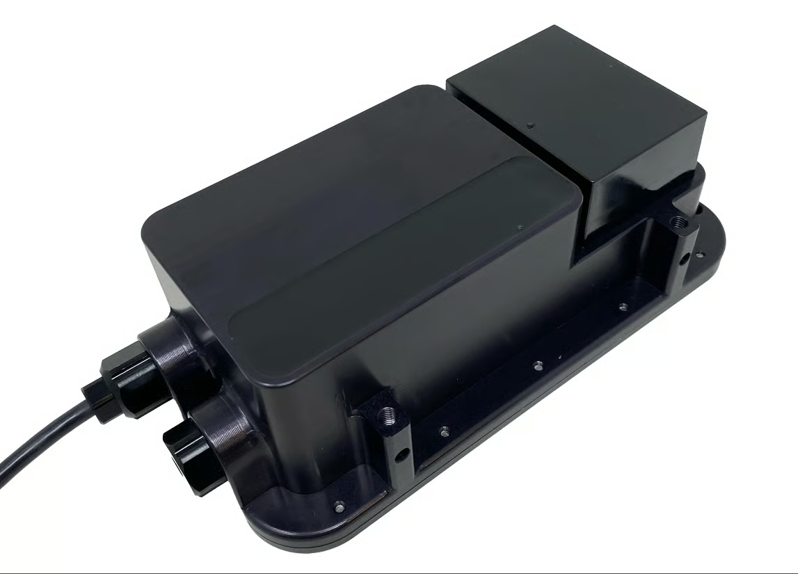
The Surveyor 240-16 is a 240 kHz MBES designed for rapid and detailed seafloor mapping. Unlike traditional single-beam echosounders, which measure depth directly beneath the vessel, the Surveyor 240-16 emits a fan of acoustic beams, covering a wide swath of the seafloor with each ping. This results in bathymetric surveys that can be completed more than ten times faster, drastically reducing field time and costs.
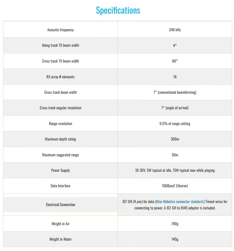
Equipped with a 16-element receive array, the Surveyor 240-16 boasts a transmit beam of approximately 4 degrees along-track and a wide 80 degrees cross-track. What sets it apart is its sophisticated angle-of-arrival estimation algorithm. This technology allows the system to determine the cross-track location of acoustic reflectors with exceptional accuracy, surpassing the limitations of conventional beam-forming techniques. While the effective cross-track beam width might be around 7 degrees with traditional methods, the Surveyor can resolve the angle of arrival to less than one degree. This precision enables the identification of typically 10-15 acoustic targets across the 80-degree swath, providing a dense and accurate representation of the bottom topography.
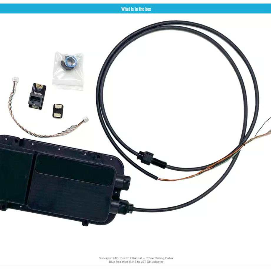
The system includes a built-in Inertial Measurement Unit (IMU), crucial for maintaining accuracy in dynamic marine environments. The integrated SonarView software utilizes the Surveyor’s IMU data for pitch and roll compensation. By combining this with position and heading information from the deployment platform (such as a USV like the BlueBoat), SonarView accurately georeferences each depth measurement, ensuring precise placement on a map.
The accompanying Cerulean SonarView software is a powerful tool for managing your survey data. It supports live data capture, real-time preview of the point cloud and fan view images, offline mission replay, and flexible data export options for post-processing. During data collection, SonarView logs essential information including Surveyor attitude (pitch and roll), receive channel data, and the vehicle’s GNSS position and heading.
For post-processing, SonarView allows you to specify the speed of sound during export, ensuring accurate calculation of geographically corrected positions and depths. Data can be exported in widely compatible formats such as CSV point cloud data, which can be easily imported into most hydrographic survey software, as well as generic point cloud viewers like CloudCompare, MeshLab, or Blender. Additionally, SonarView supports the Generic Sensor Format (GSF), a vendor-independent standard specifically designed for sonar data, ensuring broad compatibility within the maritime community. Dronelab.lv is committed to ensuring compatibility and exploring further format options based on user feedback.
The Surveyor 240-16 MBES is an ideal solution for a wide range of shallow-water applications, including:
- Bathymetric surveys of harbors, rivers, and lakes
- Hydrographic charting
- Infrastructure inspection (e.g.,bridges, dams)
- Pre- and post-dredging surveys
- Habitat mapping
With its small size, low power consumption, and ability to operate in depths of 30 meters and more, the Surveyor 240-16 is perfectly suited for deployment on small Uncrewed Surface Vessels (USVs), maximizing efficiency and reducing operational risks.
Dronelab.lv is your trusted partner for cutting-edge underwater technology. Contact us today to learn more about how the Surveyor 240-16 MBES can enhance your shallow-water surveying capabilities.